What kind of maps and for which purposes do we create them?
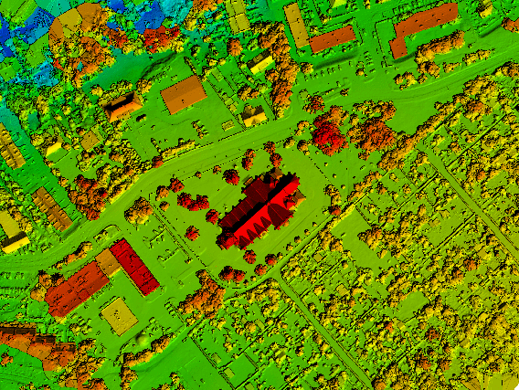
- Orthophotomaps – terrain image resulting from orthogonal processing of aerial photographs, used in cadastral, tourist, information and tourist maps, plans of shopping centers or determination of land utilization. Orthophotomaps are used for measurements and visualizations, mainly for the needs of civil engineering and for environmental analysis.
- Map for designing and planning purposes – necessary in order to obtain a building permit. Thanks to the drone we obtain measurements quickly and digitally. The map is used for planning purposes when preparing the local spatial development plan.
- Inventory Map – Map needed by the Investor when creating as-built documentation.
- Map for legal purposes related to real estate turnover, division and consolidation – a map used for establishing a land and mortgage register or for court purposes (prescription, inheritance, servitude, etc.)
What do the drones do in geodesy?
Drones in geodesy and construction are used for measurements and mapping. Drone measurements bring profits in:
- industrial,
- urban
- and infrastructure investments,
- modernization of facilities,
- railways,
- infrastructure supporting innovation,
- mining and
- agriculture.
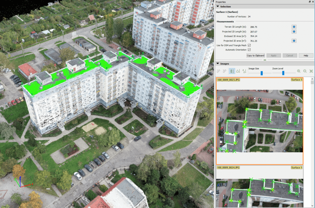
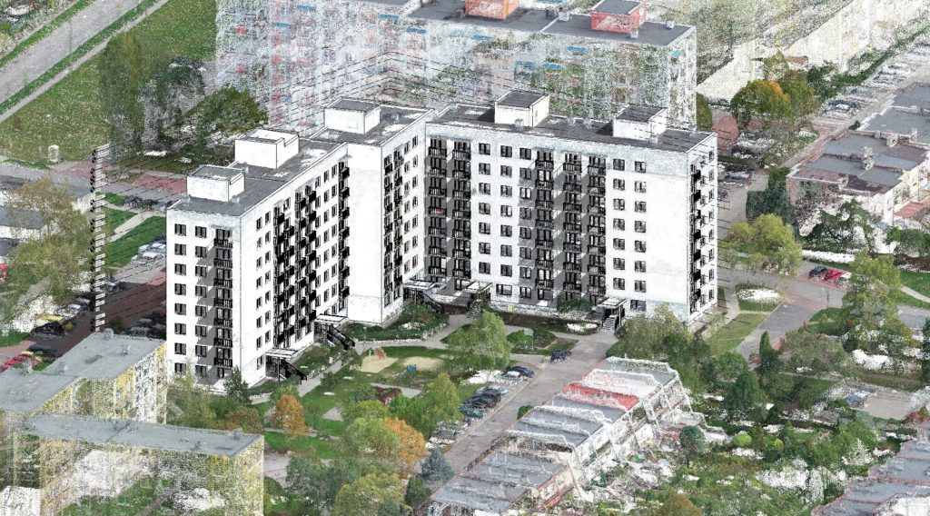
For example, for existing facilities, we offer laser, photogrammetric construction inventories that allow digital reflection of the condition of an existing facility that is about to be rebuilt.
Accurate inventory is a digital basis for structural calculations. The designer receives from us a ready-to-use model of an existing object, based on which he performs the design of rebuilding, strengthening, etc.
In turn, for investment areas or areas during implementation, thanks to our measurements, the investor or developer receives a digital terrain model containing information about the area, the mass volume.
Thanks to advanced programs, we divide the area into zones, including:
- vegetation,
- embankments,
- roads,
- facilities, depending on the needs and the type of area.
Drone measurements
Drone measurements are closely related to geodesy, but they are used in industries such as:
- industrial,
- cubature,
- earth constructions,
- geotechnics,
- agriculture,
- demolition,
- energy,
- forestry,
- photovoltaics,
- real estate,
- public utilities,
- advertising agencies,
- archeology,
- mining,
- gas,
- environmental engineering.
If you have questions or are wondering if drone measurements will improve your work, write to us! 🙂